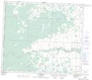
Maps showing Hayfield, 27-71-11-W6, Alberta
Hayfield is a Unincorporated area located in 27-71-11-W6, Alberta and has an elevation of 802 meters.
- Latitude: 55° 10' 15'' North (decimal: 55.1708333)
- Longitude: 119° 36' 53'' West (decimal: -119.6147222)
- Topography Feature Category: Unincorporated area
- Geographical Feature: Locality
- Canadian Province/Territory: Alberta
- Elevation: 802 meters
- Location: 27-71-11-W6
- Atlas of Canada Locator Map: Hayfield
- GPS Coordinate Locator Map: Hayfield Lat/Long
Hayfield NTS Map Sheets