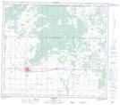
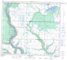
Maps showing Hay Lake, 35-82-4-W6, Alberta
Hay Lake is a Lake located in 35-82-4-W6, Alberta and has an elevation of 649 meters.
- Latitude: 56° 9' 16'' North (decimal: 56.1544444)
- Longitude: 118° 30' 40'' West (decimal: -118.5111110)
- Topography Feature Category: Lake
- Geographical Feature: Lake
- Canadian Province/Territory: Alberta
- Elevation: 649 meters
- Location: 35-82-4-W6
- Atlas of Canada Locator Map: Hay Lake
- GPS Coordinate Locator Map: Hay Lake Lat/Long
Hay Lake NTS Map Sheets