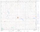
Maps showing Hayter, 17-39-1-W4, Alberta
Hayter is a Unincorporated area located in 17-39-1-W4, Alberta and has an elevation of 663 meters.
- Latitude: 52° 21' 23'' North (decimal: 52.3563889)
- Longitude: 110° 6' 28'' West (decimal: -110.1077778)
- Topography Feature Category: Unincorporated area
- Geographical Feature: Hamlet
- Canadian Province/Territory: Alberta
- Elevation: 663 meters
- Location: 17-39-1-W4
- Atlas of Canada Locator Map: Hayter
- GPS Coordinate Locator Map: Hayter Lat/Long