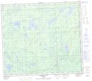
Maps showing McMillan Lake, 78-3,4-W5, Alberta
McMillan Lake is a Lake located in 78-3,4-W5, Alberta and has an elevation of 636 meters.
- Latitude: 55° 46' 18'' North (decimal: 55.7716667)
- Longitude: 114° 28' 26'' West (decimal: -114.4738888)
- Topography Feature Category: Lake
- Geographical Feature: Lake
- Canadian Province/Territory: Alberta
- Elevation: 636 meters
- Location: 78-3,4-W5
- Atlas of Canada Locator Map: McMillan Lake
- GPS Coordinate Locator Map: McMillan Lake Lat/Long
McMillan Lake NTS Map Sheets