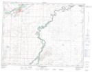
Maps showing McNab Coulee, 8-25-W4, Alberta
McNab Coulee is a Valley located in 8-25-W4, Alberta and has an elevation of 941 meters.
- Latitude: 49° 40' 2'' North (decimal: 49.6672221)
- Longitude: 113° 19' 37'' West (decimal: -113.3269443)
- Topography Feature Category: Valley
- Geographical Feature: Coulee
- Canadian Province/Territory: Alberta
- Elevation: 941 meters
- Location: 8-25-W4
- Atlas of Canada Locator Map: McNab Coulee
- GPS Coordinate Locator Map: McNab Coulee Lat/Long
McNab Coulee NTS Map Sheets