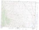
Maps showing Meadow Creek, 11-27-W4, Alberta
Meadow Creek is a River located in 11-27-W4, Alberta and has an elevation of 994 meters.
- Latitude: 49° 57' 26'' North (decimal: 49.9572221)
- Longitude: 113° 38' 59'' West (decimal: -113.6497222)
- Topography Feature Category: River
- Geographical Feature: Creek
- Canadian Province/Territory: Alberta
- Elevation: 994 meters
- Location: 11-27-W4
- Atlas of Canada Locator Map: Meadow Creek
- GPS Coordinate Locator Map: Meadow Creek Lat/Long