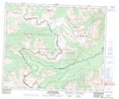
Maps showing Meadowland Creek, Alberta
Meadowland Creek is a River located in Alberta and has an elevation of 1499 meters.
- Latitude: 53° 31' 18'' North (decimal: 53.5216666)
- Longitude: 119° 42' 8'' West (decimal: -119.7022221)
- Topography Feature Category: River
- Geographical Feature: Creek
- Canadian Province/Territory: Alberta
- Elevation: 1499 meters
- Atlas of Canada Locator Map: Meadowland Creek
- GPS Coordinate Locator Map: Meadowland Creek Lat/Long
Meadowland Creek NTS Map Sheets