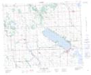
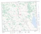
Maps showing Medicine Lodge Hills, 40-2,3-W5, Alberta
Medicine Lodge Hills is a Mountain located in 40-2,3-W5, Alberta and has an elevation of 1021 meters.
- Latitude: 52° 28' 42'' North (decimal: 52.4783332)
- Longitude: 114° 18' 8'' West (decimal: -114.3022222)
- Topography Feature Category: Mountain
- Geographical Feature: Hills
- Canadian Province/Territory: Alberta
- Elevation: 1021 meters
- Location: 40-2,3-W5
- Atlas of Canada Locator Map: Medicine Lodge Hills
- GPS Coordinate Locator Map: Medicine Lodge Hills Lat/Long
Medicine Lodge Hills NTS Map Sheets