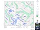
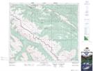
Maps showing Medicine Tent River, 44-24-W5, Alberta
Medicine Tent River is a River located in 44-24-W5, Alberta and has an elevation of 2138 meters.
- Latitude: 52° 50' 15'' North (decimal: 52.8375000)
- Longitude: 117° 24' 14'' West (decimal: -117.4038889)
- Topography Feature Category: River
- Geographical Feature: River
- Canadian Province/Territory: Alberta
- Elevation: 2138 meters
- Location: 44-24-W5
- Atlas of Canada Locator Map: Medicine Tent River
- GPS Coordinate Locator Map: Medicine Tent River Lat/Long
Medicine Tent River NTS Map Sheets