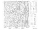
Maps showing Mercredi Lake, 125,126-5-W4, Alberta
Mercredi Lake is a Lake located in 125,126-5-W4, Alberta and has an elevation of 297 meters.
- Latitude: 59° 56' 10'' North (decimal: 59.9361111)
- Longitude: 110° 42' 11'' West (decimal: -110.7030556)
- Topography Feature Category: Lake
- Geographical Feature: Lake
- Canadian Province/Territory: Alberta
- Elevation: 297 meters
- Location: 125,126-5-W4
- Atlas of Canada Locator Map: Mercredi Lake
- GPS Coordinate Locator Map: Mercredi Lake Lat/Long
Mercredi Lake NTS Map Sheets