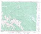
Maps showing Collie Creek Trail, 53-2-W6, Alberta
Collie Creek Trail is a Road feature located in 53-2-W6, Alberta and has an elevation of 1532 meters.
- Latitude: 53° 32' 44'' North (decimal: 53.5455840)
- Longitude: 118° 9' 33'' West (decimal: -118.1591605)
- Topography Feature Category: Road feature
- Geographical Feature: Trail
- Canadian Province/Territory: Alberta
- Elevation: 1532 meters
- Location: 53-2-W6
- Atlas of Canada Locator Map: Collie Creek Trail
- GPS Coordinate Locator Map: Collie Creek Trail Lat/Long
Collie Creek Trail NTS Map Sheets