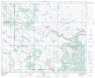
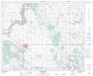
Maps showing Hardisty Trail, 12-24-8-W4, Alberta
Hardisty Trail is a Road feature located in 12-24-8-W4, Alberta.
- Latitude: 52° 28' 14'' North (decimal: 52.4706299)
- Longitude: 111° 0' 20'' West (decimal: -111.0056399)
- Topography Feature Category: Road feature
- Geographical Feature: Road
- Canadian Province/Territory: Alberta
- Location: 12-24-8-W4
- Atlas of Canada Locator Map: Hardisty Trail
- GPS Coordinate Locator Map: Hardisty Trail Lat/Long
Hardisty Trail NTS Map Sheets