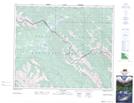
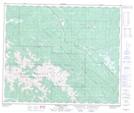
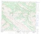
Maps showing Hoff Range, 52,53,54-2,3,4-W6, Alberta
Hoff Range is a Mountain located in 52,53,54-2,3,4-W6, Alberta and has an elevation of 1762 meters.
- Latitude: 53° 36' North (decimal: 53.5999999)
- Longitude: 118° 25' West (decimal: -118.4166667)
- Topography Feature Category: Mountain
- Geographical Feature: Range
- Canadian Province/Territory: Alberta
- Elevation: 1762 meters
- Location: 52,53,54-2,3,4-W6
- Atlas of Canada Locator Map: Hoff Range
- GPS Coordinate Locator Map: Hoff Range Lat/Long
Hoff Range NTS Map Sheets