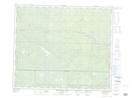
Maps showing Mahon Creek Trail, 56-5-W6, Alberta
Mahon Creek Trail is a Road feature located in 56-5-W6, Alberta.
- Latitude: 53° 48' 20'' North (decimal: 53.8055556)
- Longitude: 118° 41' 00'' West (decimal: -118.6833332)
- Topography Feature Category: Road feature
- Geographical Feature: Trail
- Canadian Province/Territory: Alberta
- Location: 56-5-W6
- Atlas of Canada Locator Map: Mahon Creek Trail
- GPS Coordinate Locator Map: Mahon Creek Trail Lat/Long
Mahon Creek Trail NTS Map Sheets