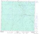
Maps showing May Hill, 76-16-W4, Alberta
May Hill is a Mountain located in 76-16-W4, Alberta and has an elevation of 845 meters.
- Latitude: 55° 33' 45'' North (decimal: 55.5625000)
- Longitude: 112° 24' 13'' West (decimal: -112.4036110)
- Topography Feature Category: Mountain
- Geographical Feature: Hill
- Canadian Province/Territory: Alberta
- Elevation: 845 meters
- Location: 76-16-W4
- Atlas of Canada Locator Map: May Hill
- GPS Coordinate Locator Map: May Hill Lat/Long
May Hill NTS Map Sheets