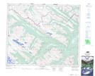
Maps showing Monoghan Creek Trail, 53-7-W6, Alberta
Monoghan Creek Trail is a Road feature located in 53-7-W6, Alberta and has an elevation of 2002 meters.
- Latitude: 53° 32' 46'' North (decimal: 53.5462219)
- Longitude: 118° 58' 9'' West (decimal: -118.9690280)
- Topography Feature Category: Road feature
- Geographical Feature: Trail
- Canadian Province/Territory: Alberta
- Elevation: 2002 meters
- Location: 53-7-W6
- Atlas of Canada Locator Map: Monoghan Creek Trail
- GPS Coordinate Locator Map: Monoghan Creek Trail Lat/Long
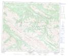
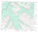
Monoghan Creek Trail NTS Map Sheets