Maps showing Mushroom Peak, 38-24-W5, Alberta
Mushroom Peak is a Mountain located in 38-24-W5, Alberta and has an elevation of 2878 meters.
- Latitude: 52° 18' 42'' North (decimal: 52.3116666)
- Longitude: 117° 23' 50'' West (decimal: -117.3972221)
- Topography Feature Category: Mountain
- Geographical Feature: Peaks
- Canadian Province/Territory: Alberta
- Elevation: 2878 meters
- Location: 38-24-W5
- Atlas of Canada Locator Map: Mushroom Peak
- GPS Coordinate Locator Map: Mushroom Peak Lat/Long
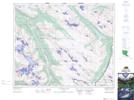
Mushroom Peak NTS Map Sheets