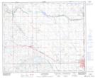
Maps showing Stretton Creek, 16-52-3-W4, Alberta
Stretton Creek is a River located in 16-52-3-W4, Alberta and has an elevation of 659 meters.
- Latitude: 53° 29' 27'' North (decimal: 53.4908333)
- Longitude: 110° 23' 51'' West (decimal: -110.3974999)
- Topography Feature Category: River
- Geographical Feature: Creek
- Canadian Province/Territory: Alberta
- Elevation: 659 meters
- Location: 16-52-3-W4
- Atlas of Canada Locator Map: Stretton Creek
- GPS Coordinate Locator Map: Stretton Creek Lat/Long
Stretton Creek NTS Map Sheets