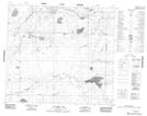
Maps showing Buffalo Creek, 2-87-17-W4, Alberta
Buffalo Creek is a River located in 2-87-17-W4, Alberta and has an elevation of 511 meters.
- Latitude: 56° 31' 15'' North (decimal: 56.5208333)
- Longitude: 112° 36' 23'' West (decimal: -112.6063889)
- Topography Feature Category: River
- Geographical Feature: Creek
- Canadian Province/Territory: Alberta
- Elevation: 511 meters
- Location: 2-87-17-W4
- Atlas of Canada Locator Map: Buffalo Creek
- GPS Coordinate Locator Map: Buffalo Creek Lat/Long
Buffalo Creek NTS Map Sheets