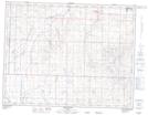
Maps showing Buffalo Hill, 19-23-W4, Alberta
Buffalo Hill is a Mountain located in 19-23-W4, Alberta and has an elevation of 1146 meters.
- Latitude: 50° 35' 59'' North (decimal: 50.5997222)
- Longitude: 113° 9' 9'' West (decimal: -113.1525000)
- Topography Feature Category: Mountain
- Geographical Feature: Hill
- Canadian Province/Territory: Alberta
- Elevation: 1146 meters
- Location: 19-23-W4
- Atlas of Canada Locator Map: Buffalo Hill
- GPS Coordinate Locator Map: Buffalo Hill Lat/Long