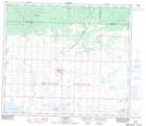
Maps showing Buffalo Lake, 74-7-W6, Alberta
Buffalo Lake is a Lake located in 74-7-W6, Alberta and has an elevation of 731 meters.
- Latitude: 55° 22' 48'' North (decimal: 55.3799999)
- Longitude: 118° 58' 30'' West (decimal: -118.9750000)
- Topography Feature Category: Lake
- Geographical Feature: Lake
- Canadian Province/Territory: Alberta
- Elevation: 731 meters
- Location: 74-7-W6
- Atlas of Canada Locator Map: Buffalo Lake
- GPS Coordinate Locator Map: Buffalo Lake Lat/Long
Buffalo Lake NTS Map Sheets