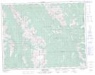
Maps showing Bull Creek Hills, 12,13,24-17-5-W5, Alberta
Bull Creek Hills is a Mountain located in 12,13,24-17-5-W5, Alberta.
- Latitude: 50° 25' 31'' North (decimal: 50.4252778)
- Longitude: 114° 34' 22'' West (decimal: -114.5727778)
- Topography Feature Category: Mountain
- Geographical Feature: Hills
- Canadian Province/Territory: Alberta
- Location: 12,13,24-17-5-W5
- Atlas of Canada Locator Map: Bull Creek Hills
- GPS Coordinate Locator Map: Bull Creek Hills Lat/Long
Bull Creek Hills NTS Map Sheets