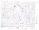
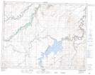
Maps showing Bullhorn Coulee, 4-26-W4, Alberta
Bullhorn Coulee is a Valley located in 4-26-W4, Alberta and has an elevation of 1146 meters.
- Latitude: 49° 16' 51'' North (decimal: 49.2808332)
- Longitude: 113° 21' 50'' West (decimal: -113.3638889)
- Topography Feature Category: Valley
- Geographical Feature: Coulee
- Canadian Province/Territory: Alberta
- Elevation: 1146 meters
- Location: 4-26-W4
- Atlas of Canada Locator Map: Bullhorn Coulee
- GPS Coordinate Locator Map: Bullhorn Coulee Lat/Long
Bullhorn Coulee NTS Map Sheets