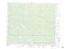
Maps showing Burleigh Creek, 57-4-W6, Alberta
Burleigh Creek is a River located in 57-4-W6, Alberta and has an elevation of 1295 meters.
- Latitude: 53° 54' 40'' North (decimal: 53.9111110)
- Longitude: 118° 33' 34'' West (decimal: -118.5594443)
- Topography Feature Category: River
- Geographical Feature: Creek
- Canadian Province/Territory: Alberta
- Elevation: 1295 meters
- Location: 57-4-W6
- Atlas of Canada Locator Map: Burleigh Creek
- GPS Coordinate Locator Map: Burleigh Creek Lat/Long
Burleigh Creek NTS Map Sheets