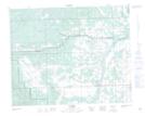
Maps showing The Snakes Head, 10-33-5-W5, Alberta
The Snakes Head is a Mountain located in 10-33-5-W5, Alberta and has an elevation of 1103 meters.
- Latitude: 51° 48' 23'' North (decimal: 51.8063888)
- Longitude: 114° 38' 36'' West (decimal: -114.6433333)
- Topography Feature Category: Mountain
- Geographical Feature: Head
- Canadian Province/Territory: Alberta
- Elevation: 1103 meters
- Location: 10-33-5-W5
- Atlas of Canada Locator Map: The Snakes Head
- GPS Coordinate Locator Map: The Snakes Head Lat/Long