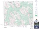
Maps showing Snowflake Lake, 30-14-W5, Alberta
Snowflake Lake is a Lake located in 30-14-W5, Alberta and has an elevation of 2429 meters.
- Latitude: 51° 35' 53'' North (decimal: 51.5980556)
- Longitude: 115° 49' 58'' West (decimal: -115.8327777)
- Topography Feature Category: Lake
- Geographical Feature: Lake
- Canadian Province/Territory: Alberta
- Elevation: 2429 meters
- Location: 30-14-W5
- Atlas of Canada Locator Map: Snowflake Lake
- GPS Coordinate Locator Map: Snowflake Lake Lat/Long
Snowflake Lake NTS Map Sheets