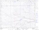
Maps showing Sounding Creek Reservoir, 30-5,6-W4, Alberta
Sounding Creek Reservoir is a Lake located in 30-5,6-W4, Alberta and has an elevation of 720 meters.
- Latitude: 51° 34' 27'' North (decimal: 51.5741666)
- Longitude: 110° 42' 20'' West (decimal: -110.7055556)
- Topography Feature Category: Lake
- Geographical Feature: Reservoir
- Canadian Province/Territory: Alberta
- Elevation: 720 meters
- Location: 30-5,6-W4
- Atlas of Canada Locator Map: Sounding Creek Reservoir
- GPS Coordinate Locator Map: Sounding Creek Reservoir Lat/Long