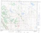
Maps showing Hebert Lake, 37-18-W4, Alberta
Hebert Lake is a Lake located in 37-18-W4, Alberta and has an elevation of 839 meters.
- Latitude: 52° 11' North (decimal: 52.1832999)
- Longitude: 112° 33' West (decimal: -112.5499999)
- Topography Feature Category: Lake
- Geographical Feature: Lake
- Canadian Province/Territory: Alberta
- Elevation: 839 meters
- Location: 37-18-W4
- Atlas of Canada Locator Map: Hebert Lake
- GPS Coordinate Locator Map: Hebert Lake Lat/Long
Hebert Lake NTS Map Sheets