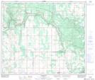
Maps showing Helina, 32-63-10-W4, Alberta
Helina is a Unincorporated area located in 32-63-10-W4, Alberta and has an elevation of 597 meters.
- Latitude: 54° 29' 5'' North (decimal: 54.4847222)
- Longitude: 111° 29' 42'' West (decimal: -111.4949999)
- Topography Feature Category: Unincorporated area
- Geographical Feature: Locality
- Canadian Province/Territory: Alberta
- Elevation: 597 meters
- Location: 32-63-10-W4
- Atlas of Canada Locator Map: Helina
- GPS Coordinate Locator Map: Helina Lat/Long
Helina NTS Map Sheets