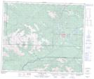
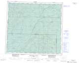
Maps showing Henrietta Creek, 56-9-W6, Alberta
Henrietta Creek is a River located in 56-9-W6, Alberta and has an elevation of 1808 meters.
- Latitude: 53° 47' 54'' North (decimal: 53.7983333)
- Longitude: 119° 15' 7'' West (decimal: -119.2519444)
- Topography Feature Category: River
- Geographical Feature: Creek
- Canadian Province/Territory: Alberta
- Elevation: 1808 meters
- Location: 56-9-W6
- Atlas of Canada Locator Map: Henrietta Creek
- GPS Coordinate Locator Map: Henrietta Creek Lat/Long
Henrietta Creek NTS Map Sheets