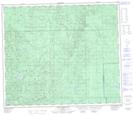
Maps showing Henry Creek, 69-9-W5, Alberta
Henry Creek is a River located in 69-9-W5, Alberta and has an elevation of 775 meters.
- Latitude: 54° 58' 9'' North (decimal: 54.9691667)
- Longitude: 115° 18' 30'' West (decimal: -115.3083333)
- Topography Feature Category: River
- Geographical Feature: Creek
- Canadian Province/Territory: Alberta
- Elevation: 775 meters
- Location: 69-9-W5
- Atlas of Canada Locator Map: Henry Creek
- GPS Coordinate Locator Map: Henry Creek Lat/Long
Henry Creek NTS Map Sheets