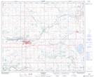
Maps showing Hidden Lake, 34-50-5-W4, Alberta
Hidden Lake is a Lake located in 34-50-5-W4, Alberta and has an elevation of 615 meters.
- Latitude: 53° 21' 12'' North (decimal: 53.3533333)
- Longitude: 110° 38' 26'' West (decimal: -110.6405556)
- Topography Feature Category: Lake
- Geographical Feature: Lake
- Canadian Province/Territory: Alberta
- Elevation: 615 meters
- Location: 34-50-5-W4
- Atlas of Canada Locator Map: Hidden Lake
- GPS Coordinate Locator Map: Hidden Lake Lat/Long
Hidden Lake NTS Map Sheets