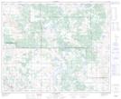
Maps showing Highland Heights, 42-5-W4, Alberta
Highland Heights is a Mountain located in 42-5-W4, Alberta and has an elevation of 704 meters.
- Latitude: 52° 39' 29'' North (decimal: 52.6580555)
- Longitude: 110° 35' 11'' West (decimal: -110.5863889)
- Topography Feature Category: Mountain
- Geographical Feature: Hills
- Canadian Province/Territory: Alberta
- Elevation: 704 meters
- Location: 42-5-W4
- Atlas of Canada Locator Map: Highland Heights
- GPS Coordinate Locator Map: Highland Heights Lat/Long
Highland Heights NTS Map Sheets