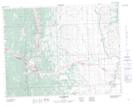
Maps showing Hillcrest Mountain, 1,12-7-4-W5, Alberta
Hillcrest Mountain is a Mountain located in 1,12-7-4-W5, Alberta and has an elevation of 2024 meters.
- Latitude: 49° 32' 18'' North (decimal: 49.5383333)
- Longitude: 114° 24' 46'' West (decimal: -114.4127778)
- Topography Feature Category: Mountain
- Geographical Feature: Mountain
- Canadian Province/Territory: Alberta
- Elevation: 2024 meters
- Location: 1,12-7-4-W5
- Atlas of Canada Locator Map: Hillcrest Mountain
- GPS Coordinate Locator Map: Hillcrest Mountain Lat/Long