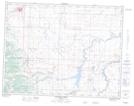
Maps showing Hill Spring, 18-4-27-W4, Alberta
Hill Spring is a Village located in 18-4-27-W4, Alberta and has an elevation of 1177 meters.
- Latitude: 49° 17' 35'' North (decimal: 49.2930555)
- Longitude: 113° 37' 20'' West (decimal: -113.6222222)
- Topography Feature Category: Village
- Geographical Feature: Village
- Canadian Province/Territory: Alberta
- Elevation: 1177 meters
- Location: 18-4-27-W4
- Atlas of Canada Locator Map: Hill Spring
- GPS Coordinate Locator Map: Hill Spring Lat/Long
Hill Spring NTS Map Sheets