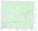
Maps showing Hoff, 55-4-W6, Alberta
Hoff is a Unincorporated area located in 55-4-W6, Alberta.
- Latitude: 53° 47' 37'' North (decimal: 53.7936111)
- Longitude: 118° 27' 36'' West (decimal: -118.4599999)
- Topography Feature Category: Unincorporated area
- Geographical Feature: Railway Point
- Canadian Province/Territory: Alberta
- Location: 55-4-W6
- Atlas of Canada Locator Map: Hoff
- GPS Coordinate Locator Map: Hoff Lat/Long
Hoff NTS Map Sheets