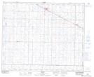
Maps showing Holden, 14-49-16-W4, Alberta
Holden is a Village located in 14-49-16-W4, Alberta and has an elevation of 688 meters.
- Latitude: 53° 14' 00'' North (decimal: 53.2333333)
- Longitude: 112° 14' 2'' West (decimal: -112.2338888)
- Topography Feature Category: Village
- Geographical Feature: Village
- Canadian Province/Territory: Alberta
- Elevation: 688 meters
- Location: 14-49-16-W4
- Atlas of Canada Locator Map: Holden
- GPS Coordinate Locator Map: Holden Lat/Long