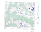
Maps showing Mount Holmes, 50-12-W6, Alberta
Mount Holmes is a Mountain located in 50-12-W6, Alberta.
- Latitude: 53° 21' 28'' North (decimal: 53.3577777)
- Longitude: 119° 37' 51'' West (decimal: -119.6308333)
- Topography Feature Category: Mountain
- Geographical Feature: Mount
- Canadian Province/Territory: Alberta
- Location: 50-12-W6
- Atlas of Canada Locator Map: Mount Holmes
- GPS Coordinate Locator Map: Mount Holmes Lat/Long
Mount Holmes NTS Map Sheets