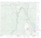
Maps showing Mildred Lake, 6-93-10-W4, Alberta
Mildred Lake is a Unincorporated area located in 6-93-10-W4, Alberta and has an elevation of 304 meters.
- Latitude: 57° 2' North (decimal: 57.0333333)
- Longitude: 111° 36' West (decimal: -111.5999999)
- Topography Feature Category: Unincorporated area
- Geographical Feature: Locality
- Canadian Province/Territory: Alberta
- Elevation: 304 meters
- Location: 6-93-10-W4
- Atlas of Canada Locator Map: Mildred Lake
- GPS Coordinate Locator Map: Mildred Lake Lat/Long
Mildred Lake NTS Map Sheets