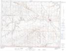
Maps showing Milk River, 28-2-16-W4, Alberta
Milk River is a Town located in 28-2-16-W4, Alberta and has an elevation of 1051 meters.
- Latitude: 49° 9' 00'' North (decimal: 49.1499999)
- Longitude: 112° 5' 12'' West (decimal: -112.0866666)
- Topography Feature Category: Town
- Geographical Feature: Town
- Canadian Province/Territory: Alberta
- Elevation: 1051 meters
- Location: 28-2-16-W4
- Atlas of Canada Locator Map: Milk River
- GPS Coordinate Locator Map: Milk River Lat/Long
Milk River NTS Map Sheets