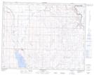
Maps showing Milo, 31-18-21-W4, Alberta
Milo is a Village located in 31-18-21-W4, Alberta and has an elevation of 882 meters.
- Latitude: 50° 34' 12'' North (decimal: 50.5700000)
- Longitude: 112° 52' 55'' West (decimal: -112.8819444)
- Topography Feature Category: Village
- Geographical Feature: Village
- Canadian Province/Territory: Alberta
- Elevation: 882 meters
- Location: 31-18-21-W4
- Atlas of Canada Locator Map: Milo
- GPS Coordinate Locator Map: Milo Lat/Long
Milo NTS Map Sheets