Maps showing Minewakun Lake, 28-17-W5, Alberta
Minewakun Lake is a Lake located in 28-17-W5, Alberta and has an elevation of 2090 meters.
- Latitude: 51° 25' 49'' North (decimal: 51.4302778)
- Longitude: 116° 16' 15'' West (decimal: -116.2708332)
- Topography Feature Category: Lake
- Geographical Feature: Lake
- Canadian Province/Territory: Alberta
- Elevation: 2090 meters
- Location: 28-17-W5
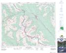
- Atlas of Canada Locator Map: Minewakun Lake
- GPS Coordinate Locator Map: Minewakun Lake Lat/Long