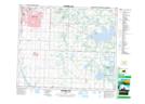
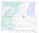
Maps showing Ministik Lake, 50-21-W4, Alberta
Ministik Lake is a Lake located in 50-21-W4, Alberta and has an elevation of 760 meters.
- Latitude: 53° 20' 17'' North (decimal: 53.3380555)
- Longitude: 113° 1' 17'' West (decimal: -113.0213888)
- Topography Feature Category: Lake
- Geographical Feature: Lake
- Canadian Province/Territory: Alberta
- Elevation: 760 meters
- Location: 50-21-W4
- Atlas of Canada Locator Map: Ministik Lake
- GPS Coordinate Locator Map: Ministik Lake Lat/Long
Ministik Lake NTS Map Sheets