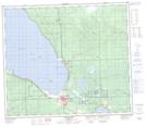
Maps showing Mitsue, 30-72-4-W5, Alberta
Mitsue is a Unincorporated area located in 30-72-4-W5, Alberta and has an elevation of 589 meters.
- Latitude: 55° 15' 39'' North (decimal: 55.2608332)
- Longitude: 114° 36' 11'' West (decimal: -114.6030555)
- Topography Feature Category: Unincorporated area
- Geographical Feature: Locality
- Canadian Province/Territory: Alberta
- Elevation: 589 meters
- Location: 30-72-4-W5
- Atlas of Canada Locator Map: Mitsue
- GPS Coordinate Locator Map: Mitsue Lat/Long
Mitsue NTS Map Sheets