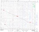
Maps showing Bawlf, 31-45-17-W4, Alberta
Bawlf is a Village located in 31-45-17-W4, Alberta and has an elevation of 706 meters.
- Latitude: 52° 55' 10'' North (decimal: 52.9194443)
- Longitude: 112° 27' 58'' West (decimal: -112.4661109)
- Topography Feature Category: Village
- Geographical Feature: Village
- Canadian Province/Territory: Alberta
- Elevation: 706 meters
- Location: 31-45-17-W4
- Atlas of Canada Locator Map: Bawlf
- GPS Coordinate Locator Map: Bawlf Lat/Long