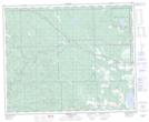
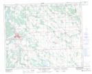
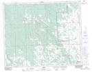
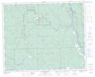
Maps showing Buster Creek, 19-41-7-W5, Alberta
Buster Creek is a River located in 19-41-7-W5, Alberta and has an elevation of 1024 meters.
- Latitude: 52° 32' 29'' North (decimal: 52.5413889)
- Longitude: 114° 59' 48'' West (decimal: -114.9966666)
- Topography Feature Category: River
- Geographical Feature: Creek
- Canadian Province/Territory: Alberta
- Elevation: 1024 meters
- Location: 19-41-7-W5
- Atlas of Canada Locator Map: Buster Creek
- GPS Coordinate Locator Map: Buster Creek Lat/Long
Buster Creek NTS Map Sheets