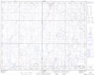
Maps showing Cabin Lake, 20-24-9-W4, Alberta
Cabin Lake is a Unincorporated area located in 20-24-9-W4, Alberta and has an elevation of 728 meters.
- Latitude: 51° 3' 47'' North (decimal: 51.0630555)
- Longitude: 111° 13' 41'' West (decimal: -111.2280556)
- Topography Feature Category: Unincorporated area
- Geographical Feature: Locality
- Canadian Province/Territory: Alberta
- Elevation: 728 meters
- Location: 20-24-9-W4
- Atlas of Canada Locator Map: Cabin Lake
- GPS Coordinate Locator Map: Cabin Lake Lat/Long