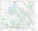
Maps showing Calder Lake, 21-57-8-W4, Alberta
Calder Lake is a Lake located in 21-57-8-W4, Alberta.
- Latitude: 53° 56' 35'' North (decimal: 53.9430555)
- Longitude: 111° 7' 52'' West (decimal: -111.1311111)
- Topography Feature Category: Lake
- Geographical Feature: Lake
- Canadian Province/Territory: Alberta
- Location: 21-57-8-W4
- Atlas of Canada Locator Map: Calder Lake
- GPS Coordinate Locator Map: Calder Lake Lat/Long