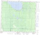
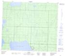
Maps showing Calling Lake, 20-72-21-W4, Alberta
Calling Lake is a Unincorporated area located in 20-72-21-W4, Alberta and has an elevation of 597 meters.
- Latitude: 55° 12' 52'' North (decimal: 55.2144444)
- Longitude: 113° 11' 49'' West (decimal: -113.1969443)
- Topography Feature Category: Unincorporated area
- Geographical Feature: Hamlet
- Canadian Province/Territory: Alberta
- Elevation: 597 meters
- Location: 20-72-21-W4
- Atlas of Canada Locator Map: Calling Lake
- GPS Coordinate Locator Map: Calling Lake Lat/Long
Calling Lake NTS Map Sheets