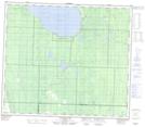
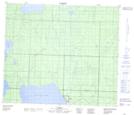
Maps showing Calling Lake, 72-22-W4, Alberta
Calling Lake is a Lake located in 72-22-W4, Alberta and has an elevation of 598 meters.
- Latitude: 55° 14' 32'' North (decimal: 55.2422221)
- Longitude: 113° 18' 40'' West (decimal: -113.3111111)
- Topography Feature Category: Lake
- Geographical Feature: Lake
- Canadian Province/Territory: Alberta
- Elevation: 598 meters
- Location: 72-22-W4
- Atlas of Canada Locator Map: Calling Lake
- GPS Coordinate Locator Map: Calling Lake Lat/Long
Calling Lake NTS Map Sheets